Constellation, Flying Fish
Volans
A flying fish of tropical seas, placed in the southern sky by Dutch navigators. It is shown fleeing from Dorado, a fish that hunts it in real life.
From New York the constellation Volans never rises above the horizon: it belongs to the other hemisphere’s sky.
From New York the constellation Volans never rises above the horizon: it belongs to the other hemisphere’s sky.
In the 3D sky
The sky over New York turned towards Volans. Drag to look around.
Loading 3D view...
Drag to look around, pinch or scroll to zoom.
Evening visibility over the year
Height of the constellation’s centre above the horizon at 10 pm local time on the 15th of each month, from New York. Above about 30° it is well placed.
Name and history
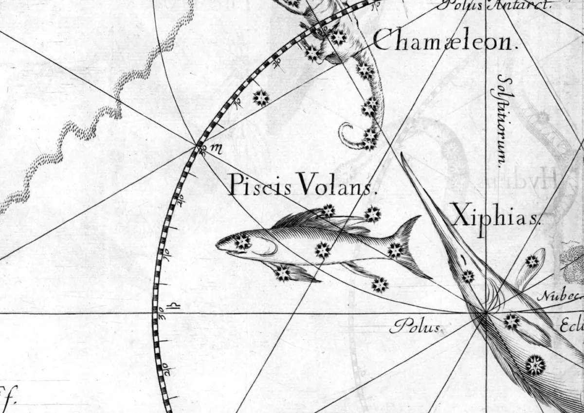
Volans is one of the twelve figures created from the observations of the Dutch navigators Pieter Dirkszoon Keyser and Frederick de Houtman at the end of the 16th century. It shows a real tropical fish that leaps out of the water and glides on wing-like fins. Sailors sometimes found these fish on deck and ate them. In the sky it is chased by Dorado, a fish that preys on flying fish in the real ocean. There are no legends connected with it.
Petrus Plancius first showed it on his globe of 1598 under the Dutch name Vliegendenvis. Johann Bayer called it Piscis Volans, the flying fish, in 1603, and that name was used until the 19th century. In 1844 John Herschel suggested shortening it to Volans. Francis Baily adopted the short form in 1845, and it has kept that name ever since.
Sources: Ian Ridpath, Star Tales: Volans
Brightest stars
| Star | Designation | Magnitude | Distance |
|---|---|---|---|
| β Vol | β Vol | 3.77 | 108 light-years |
| γ2 Vol | γ2 Vol | 3.78 | 140 light-years |
| ζ Vol | ζ Vol | 3.93 | 141 light-years |
| δ Vol | δ Vol | 3.97 | 738 light-years |
| α Vol | α Vol | 4.00 | 125 light-years |
| ε Vol | ε Vol | 4.35 | 562 light-years |
Facts
| Area | about 141 square degrees (76 of 88) |
|---|---|
| IAU abbreviation | Vol |
| Sky | Southern sky |
| Origin | First shown as Vliegendenvis on a celestial globe by Petrus Plancius in 1598, from observations by Keyser and de Houtman |
| Stars brighter than magnitude 5 | 6 |
| Centre (J2000) | 8.0 h, -69° |
Deep-sky objects
Galaxies, clusters and nebulae brighter than magnitude 9, from the OpenNGC catalogue. Most need binoculars or a telescope and a dark sky.
No deep-sky object brighter than magnitude 9.
Boundaries: International Astronomical Union, via Astronomy Engine. Areas are computed from the boundaries by sampling (within about one percent). Names and lines: Stellarium. Stars: HYG Database. Deep-sky objects: OpenNGC. Calculated with Astronomy Engine, an open-source library verified against the US Naval Observatory and NASA JPL. Data sources
How to use this page
Choose your place and a night at the top. The answer and the 3D view show where the constellation is, when it is highest and whether it rises at all from where you are. The chart shows its stars and lines, and the tables list its brightest stars and the deep-sky objects inside it.
Frequently asked questions
When is a constellation best seen?
When it is highest in a dark sky, which the page gives for the night you pick. Each constellation is best placed in a particular season, because the stars rise about four minutes earlier every night.
Why can I not see a constellation from my place?
Constellations far south of the celestial equator never rise from northern places, and those far north never rise from southern ones. The page says when this is the case.
What are the constellation boundaries?
The International Astronomical Union divides the sky into 88 areas with official boundaries. The stick figures are only a drawing aid, the boundaries say which constellation a point in the sky belongs to.
Related guides
- How to learn the constellationsStart with one bright pattern you cannot miss, use it as a signpost to its neighbours, and come back a month later: the sky will have turned, and you will know a little more of it.
- Altitude and azimuth: finding things in the skyTwo angles tell you exactly where to look: which direction, and how high.
- Light pollution and dark skies: the Bortle scaleFrom a city centre you can count a few dozen stars. From a truly dark site you can count a few thousand, with the Milky Way bright enough to cast a shadow. The Bortle scale puts a number on the difference.
- Binoculars for stargazing: what to buy and what to look atA pair of 7x50 or 10x50 binoculars shows the craters of the Moon, the moons of Jupiter, dozens of star clusters and the Andromeda Galaxy, for a fraction of the cost of a telescope.